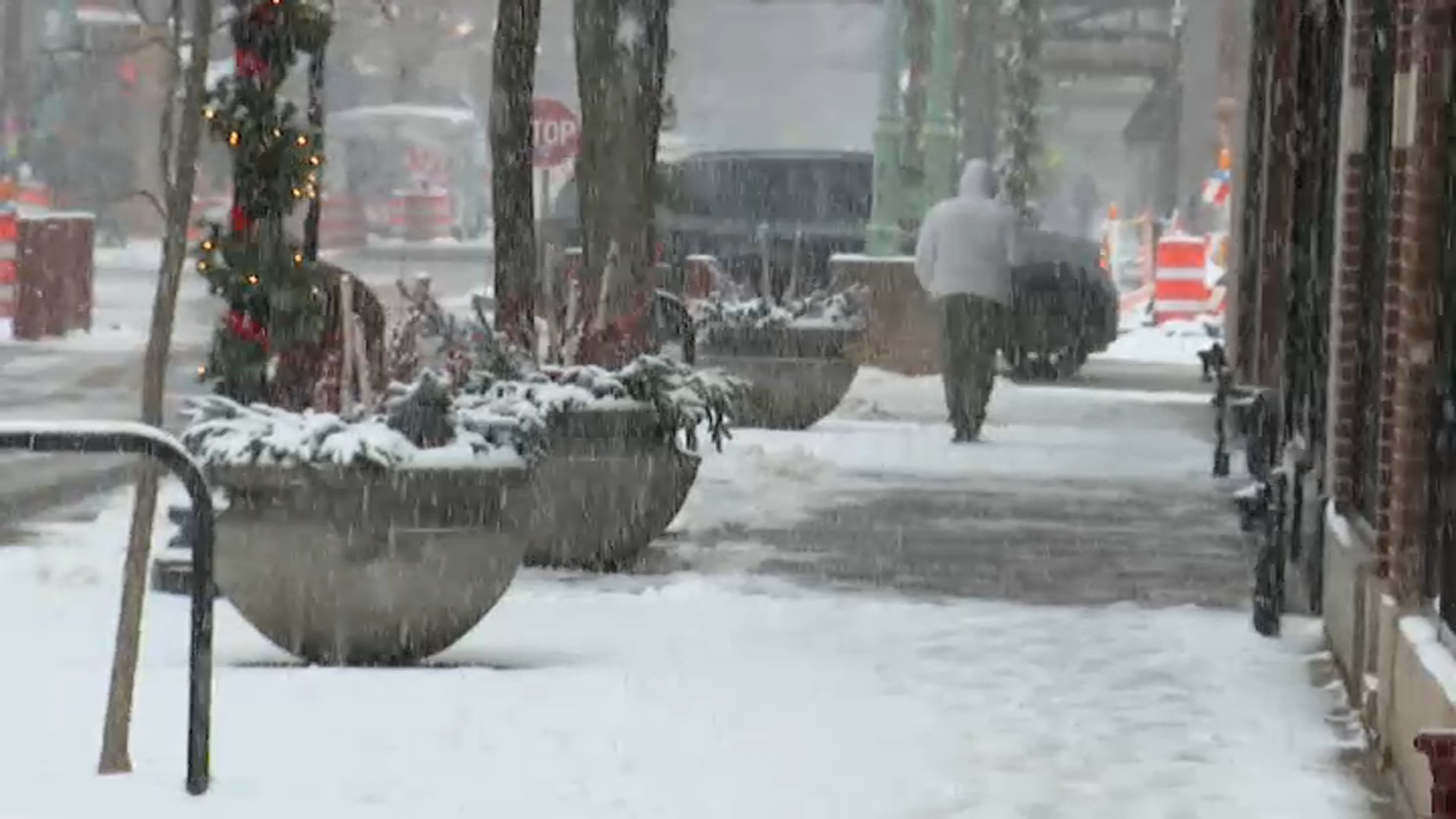
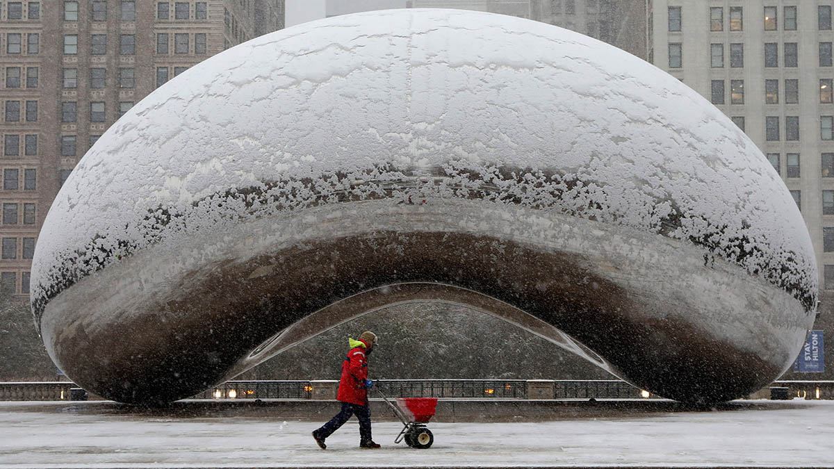
A winter weather advisory will go into effect Monday afternoon for the entire Chicago area, bringing more accumulating snow and slippery conditions just in time for the evening commute.
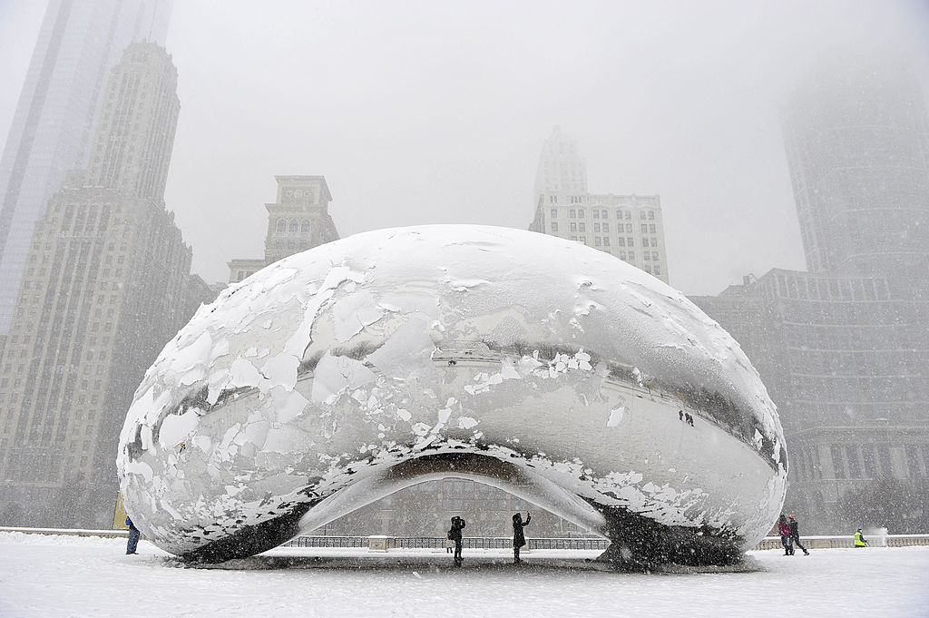
The weather advisory comes after a powerful winter storm dumped more than 11 inches of snow across northeastern Illinois and left hundreds of flights canceled over the Thanksgiving holiday weekend.
According to the National Weather Service, Monday’s winter weather advisory begins at 2 p.m. and lasts through midnight for the entire Chicago area, including northwest Indiana. Earlier Monday morning, the NWS warned of shallow, freezing fog, with low visibility and patchy, slick spots on roadways.
Patchy shallow freezing fog is possible early this morning outside of Chicago. Where locally dense fog develops, patchy slick spots may also occur due to the sub-freezing temperatures. #ILwx #INwx pic.twitter.com/2z9TXNIfNz
— NWS Chicago (@NWSChicago) December 1, 2025
By about 12 p.m. Monday, snow was expected to move in from the west and spread east. By 3 p.m., the snow will be widespread, NBC 5 Storm Team Meteorologist Alicia Roman said, with the entire Chicago area expected to be snow-covered later Monday afternoon and hazardous conditions for the rush hour drive.
“A lot of people leaving work at 5 p.m. to 5:30 p.m., and snow-covered roads could be a problem,” Roman said, with bursts of snow possible.
The Chicago Office of Emergency Management and Communications warned drivers to plan on slippery road conditions.
“The hazardous conditions could impact the Monday evening commute. Slow down and use caution while traveling,” the OEMC said in a release.
The winter weather was expected to bring between two and three inches of additional snowfall in counties to the north, with higher totals to the south. Four inches or more of snow were possible south of I-80, the NWS, said, with reduced visibility expected.
Snow will spread east across the area this afternoon, persisting this evening before ending late. Snow will impact the afternoon/evening commute with hazardous travel conditions. Amounts from 2-3" north to 2-4" south are expected. #ILwx #INwx pic.twitter.com/fAq5tbWcAQ
— NWS Chicago (@NWSChicago) December 1, 2025
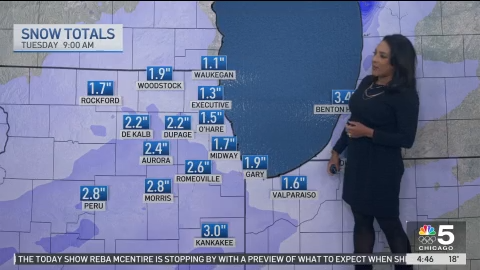
How much snow could fall?
While it won’t be a lot of snow, it will be a “nuisance,” Roman said, as it comes during the afternoon and evening commute.
According to Roman, predicted snow totals were about 1.1 inches in Waukegan, 2.2 inches in DeKalb, 2.6 inches in Romeoville and 3.0 inches in Kankakee.
Locally higher totals were possible, Roman added.
The snow was expected to gradually come to an end overnight, Roman said.
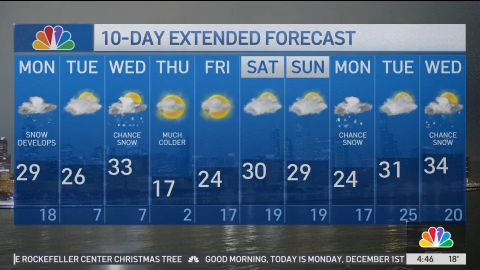
Much colder temperatures
Monday’s high temperature would be 29 degrees, Roman said, and dropping into the teens overnight. By Thursday, much colder air would move in, Roman said.
Want more insights? Join Grow With Caliber - our career elevating newsletter and get our take on the future of work delivered weekly.
